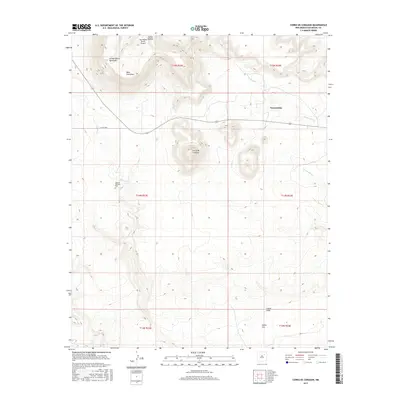
2017 Map of Cerro De Corazon
USGS Topo · Published 2017About this map
Trementina sits within a landscape defined by deep canyons and prominent mesas in San Miguel County. The terrain is marked by significant topographical shifts, ranging from the heights of Mesa Huerfana and the namesake Cerro de Corazon to the carved paths of Arroyo Rendia and Arroyo Manga. This modern-era survey captures a rural New Mexico ranching and residential landscape where isolated infrastructure, such as the San Miguel Ranch Airport and Co RD c48a, connects dispersed homesteads. The inclusion of the Sagrado Corazon Cem near the banks of Corazon Cr provides a specific point of interest for genealogists and local historians, anchoring the spiritual and community history of this high-desert region. The map also detail numerous named canyons, including Cañon Padilla, Cañon Indio, and Cañon Uva, illustrating the complex drainage patterns that shape the local geography.
Find a feature on this map
19 named features on this map. Tap any name to fly to it.
Don’t see what you’re looking for? This feature index may not catch every label — zoom into the map to look around manually.
Map Details
Editions of this 2017 Cerro De Corazon Map
This is the sole edition of this map. No revisions or reprints were ever made.
Other maps of this area

1892 · Watrous
USGS Topo · 1:125,000

1892 · Corazon
USGS Topo · 1:125,000

1894 · Corazon
USGS Topo · 1:125,000

1894 · Watrous
USGS Topo · 1:125,000

1954 · Santa Fe
USGS Topo · 1:250,000

1958 · Santa Fe
USGS Topo · 1:250,000

1971 · Trujillo
USGS Topo · 1:24,000

1971 · Canon Olguin
USGS Topo · 1:24,000

1972 · Variadero
USGS Topo · 1:24,000

1972 · La Silla
USGS Topo · 1:24,000