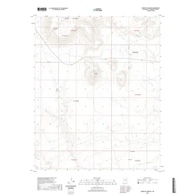
2020 Map of Cerro De Corazon
USGS Topo · Published 2020About this map
Trementina serves as the primary settlement hub in this high-desert landscape, located along Co RD c48a and Post Office LN. The terrain is defined by dramatic elevation changes, notably the prominent Cerro de Corazon and the broad Mesa Huerfana to the northwest. These highlands are dissected by a complex drainage system including Arroyo Rendia, Arroyo Manga, and Corazon Cr., which feed toward the Conchas River in the southeast corner. For those tracing local history, the Sagrado Corazon Cem stands as a significant cultural marker south of the main township. The presence of the San Miguel Ranch Airport near Cañon Padilla reflects the logistical realities of this remote ranching country, where canyons like Cañon Indio and Cañon Uva carve deep into the plateau.
Find a feature on this map
22 named features on this map. Tap any name to fly to it.
Don’t see what you’re looking for? This feature index may not catch every label — zoom into the map to look around manually.
Map Details
Editions of this 2020 Cerro De Corazon Map
This is the sole edition of this map. No revisions or reprints were ever made.
Other maps of this area

1892 · Watrous
USGS Topo · 1:125,000

1892 · Corazon
USGS Topo · 1:125,000

1894 · Corazon
USGS Topo · 1:125,000

1894 · Watrous
USGS Topo · 1:125,000

1954 · Santa Fe
USGS Topo · 1:250,000

1958 · Santa Fe
USGS Topo · 1:250,000

1971 · Trujillo
USGS Topo · 1:24,000

1971 · Canon Olguin
USGS Topo · 1:24,000

1972 · Variadero
USGS Topo · 1:24,000

1972 · La Silla
USGS Topo · 1:24,000