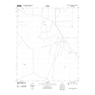
2010 Map of Cerro De La Campana
USGS Topo · Published 2010About this map
The White Sands Missile Range dominates this high-desert landscape in Socorro County, defining the modern infrastructure and restricted access of the region. The presence of the Stallion Range Center and an extensive network of military routes, such as WSMR P Route 5 and WSMR S Route 344, underscores the area's strategic importance. This modernization overlays an earlier layer of resource extraction and ranching, evidenced by the Gilmore Coal Mine and Fite Ranch near the settlement of Tokay.
Find a feature on this map
16 named features on this map. Tap any name to fly to it.
Don’t see what you’re looking for? This feature index may not catch every label — zoom into the map to look around manually.
Map Details
Editions of this 2010 Cerro De La Campana Map
This is the sole edition of this map. No revisions or reprints were ever made.
Other maps of this area

1948 · Carthage
USGS Topo · 1:62,500

1948 · Granjean Well
USGS Topo · 1:62,500

1948 · San Antonio
USGS Topo · 1:62,500

1948 · Val Verde
USGS Topo · 1:62,500

1954 · Tularosa
USGS Topo · 1:250,000

1958 · Tularosa
USGS Topo · 1:250,000
1981 · Greens Baber Well
USGS Topo · 1:24,000

1981 · Granjean Well
USGS Topo · 1:24,000
1981 · San Antonio
USGS Topo · 1:24,000
1981 · Canon Agua Buena
USGS Topo · 1:24,000