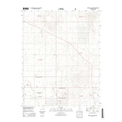
2013 Map of Cerro De Los Taoses
USGS Topo · Published 2013About this map
The high desert landscape of Taos County is dominated by the volcanic forms of Cerro de los Taoses and the neighboring Cerrito Dormilon. This 2013 survey by the U.S. Geological Survey and U.S. Forest Service reveals a sparse but increasingly partitioned region, where large tracts of the Carson National Forest meet modern residential development. Water management remains central to the character of the land, evidenced by the scattered infrastructure of Sertion Three Tank, Aguaje Tank, and Taoses Tank, as well as the drainage of the Arroyo Aguaje de la Petaca.
Find a feature on this map
20 named features on this map. Tap any name to fly to it.
Don’t see what you’re looking for? This feature index may not catch every label — zoom into the map to look around manually.
Map Details
Editions of this 2013 Cerro De Los Taoses Map
This is the sole edition of this map. No revisions or reprints were ever made.
Other maps of this area

1954 · Raton
USGS Topo · 1:250,000

1958 · Raton
USGS Topo · 1:250,000

1961 · Tres Orejas
USGS Topo · 1:24,000

1961 · Servilleta Plaza
USGS Topo · 1:24,000

1963 · Arroyo Hondo
USGS Topo · 1:24,000

1963 · Tres Piedras NE
USGS Topo · 1:24,000

1963 · Cerro De Los Taoses
USGS Topo · 1:24,000

1963 · Guadalupe Mountain
USGS Topo · 1:24,000
1963 · Petaca Peak
USGS Topo · 1:24,000
1963 · Tres Piedras
USGS Topo · 1:24,000