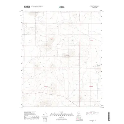
2018 Map of Cerro Hueco
USGS Topo · Published 2018About this map
Cerro Hueco rises as a prominent landmark in this high-elevation corner of Apache County, where the volcanic landscape is defined by cinder cones and basaltic flows. The terrain is deeply tied to the regional hydrology of the Little Colorado River plateau, characterized by natural depressions like Ortega Sink and intermittent drainages such as Wildcat Cr. Ranching history is visible through scattered water improvements like Blood Tank and Dead Horse Tank, which are essential for livestock in this arid environment. In the southern portion of the sheet, the elevation increases toward Cerro Montoso, while Mallory Draw cuts through the eastern slopes. The map captures a transition zone between open range and the more dramatic volcanic features that dominate the White Mountains foothills.
Find a feature on this map
11 named features on this map. Tap any name to fly to it.
Don’t see what you’re looking for? This feature index may not catch every label — zoom into the map to look around manually.
Map Details
Editions of this 2018 Cerro Hueco Map
This is the sole edition of this map. No revisions or reprints were ever made.
Other maps of this area

1886 · St Johns
USGS Topo · 1:250,000

1892 · St Johns
USGS Topo · 1:250,000

1954 · Saint Johns
USGS Topo · 1:250,000

1957 · Saint Johns
USGS Topo · 1:250,000

1958 · Saint Johns
USGS Topo · 1:250,000

1962 · Saint Johns
USGS Topo · 1:250,000

1968 · Boundary Butte
USGS Topo · 1:24,000

1968 · Springerville NW
USGS Topo · 1:24,000

1969 · Whiting Knoll
USGS Topo · 1:24,000
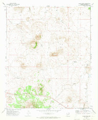
1971 · Cerro Hueco
USGS Topo · 1:24,000