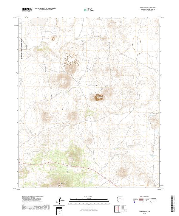
2021 Map of Cerro Hueco
USGS Topo · Published 2021About this map
Cerro Hueco dominates this high-elevation landscape in eastern Arizona, marking a terrain defined by volcanic peaks and ephemeral water catchments. The area is characterized by significant topographical relief, including the prominent summit of Cerro Montoso in the southwestern portion of the map. Water management and drainage are central to the geography here, with several named livestock tanks such as Blood Tank and Dead Horse Tank situated along the lower elevations. These features, along with Ortega Sink and the winding course of Wildcat Cr, suggest a land used primarily for ranching and grazing where reliable water sources are the primary anchors of human activity. The map reveals a sparse network of roads and tracks connecting these isolated water points across the high plateau, illustrating the enduring relationship between the local cattle economy and the semi-arid environment of the White Mountains region.
Find a feature on this map
11 named features on this map. Tap any name to fly to it.
Don’t see what you’re looking for? This feature index may not catch every label — zoom into the map to look around manually.
Map Details
Editions of this 2021 Cerro Hueco Map
This is the sole edition of this map. No revisions or reprints were ever made.
Other maps of this area

1886 · St Johns
USGS Topo · 1:250,000

1892 · St Johns
USGS Topo · 1:250,000

1954 · Saint Johns
USGS Topo · 1:250,000

1957 · Saint Johns
USGS Topo · 1:250,000

1958 · Saint Johns
USGS Topo · 1:250,000

1962 · Saint Johns
USGS Topo · 1:250,000

1968 · Boundary Butte
USGS Topo · 1:24,000

1968 · Springerville NW
USGS Topo · 1:24,000

1969 · Whiting Knoll
USGS Topo · 1:24,000
1971 · Cerro Hueco
USGS Topo · 1:24,000