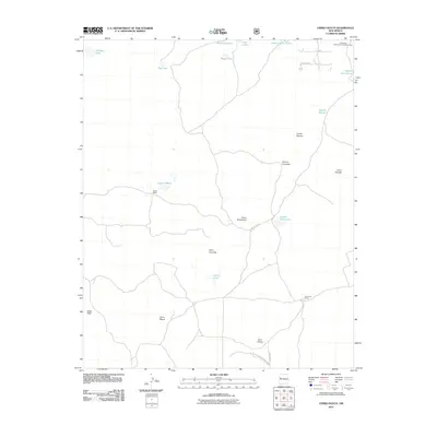
2011 Map of Cerro Hueco
USGS Topo · Published 2011About this map
Mason Ranch and Los Cerros Ranch sit within a high volcanic landscape defined by volcanic cones and ephemeral water bodies in this 2011 survey of New Mexico. The area is dominated by significant protected lands, including the El Malpais National Conservation Area and the El Malpais National Monument. These public lands preserve a complex terrain of peaks and depressions, where prominent landmarks like Cerro Hueco, Cerro Leonides, and Jacks Peak rise above a series of lagunas.
Find a feature on this map
25 named features on this map. Tap any name to fly to it.
Don’t see what you’re looking for? This feature index may not catch every label — zoom into the map to look around manually.
Map Details
Editions of this 2011 Cerro Hueco Map
This is the sole edition of this map. No revisions or reprints were ever made.
Other maps of this area

1886 · Wingate
USGS Topo · 1:250,000

1892 · Wingate
USGS Topo · 1:250,000

1952 · Valle Largo
USGS Topo · 1:24,000

1952 · Paxton Springs
USGS Topo · 1:24,000

1954 · Saint Johns
USGS Topo · 1:250,000

1954 · Gallup
USGS Topo · 1:250,000

1957 · Saint Johns
USGS Topo · 1:250,000

1958 · Gallup
USGS Topo · 1:250,000

1958 · Saint Johns
USGS Topo · 1:250,000

1959 · Gallup
USGS Topo · 1:250,000