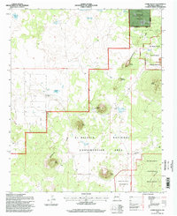
1995 Map of Cerro Hueco
USGS Topo · Published 1998About this map
The Continental Divide winds through this high-altitude landscape of western New Mexico, where the volcanic heritage of the region is evident in the numerous named volcanic peaks and basalt flows. Large land tracts are defined by the El Malpais National Monument and the West Malpais Wilderness, protecting a complex terrain of ancient lava. Traditional grazing patterns persist at Mason Ranch and Los Cerros Ranch, connected by a network of unimproved roads and the Second Standard Parallel North.
Find a feature on this map
32 named features on this map. Tap any name to fly to it.
Don’t see what you’re looking for? This feature index may not catch every label — zoom into the map to look around manually.
Map Details
Editions of this 1995 Cerro Hueco Map
This is the sole edition of this map. No revisions or reprints were ever made.
Other maps of this area

1886 · Wingate
USGS Topo · 1:250,000

1892 · Wingate
USGS Topo · 1:250,000

1952 · Valle Largo
USGS Topo · 1:24,000

1952 · Paxton Springs
USGS Topo · 1:24,000

1954 · Saint Johns
USGS Topo · 1:250,000

1954 · Gallup
USGS Topo · 1:250,000

1957 · Saint Johns
USGS Topo · 1:250,000

1958 · Gallup
USGS Topo · 1:250,000

1958 · Saint Johns
USGS Topo · 1:250,000

1959 · Gallup
USGS Topo · 1:250,000