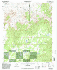
1995 Map of Cerro Parido
USGS Topo · Published 1998About this map
The high desert landscape of the McKinley and Sandoval County line is defined by a series of isolated ranches and rugged volcanic topography. Scattered habitations like the Sandoval Ranch, Joe Montoya Ranch, and Ernest Montoya Ranch suggest a persistent ranching tradition in this arid corridor. The terrain is marked by prominent elevations such as Cerro Parido and the expansive Mesa Chivato, which transitions into the protected timberlands of the Cibola National Forest. Water, a critical resource for these upland operations, is managed through a system of improved tanks and natural springs, including Seco Tank, Laguna Blanca, and Ojo Azabache. Historically, the presence of the Ignacio Chavez Grant underscores the complex land tenure of the region, where large Spanish and Mexican land grants intersect with federal forest lands and private ranching interests.
Find a feature on this map
40 named features on this map. Tap any name to fly to it.
Don’t see what you’re looking for? This feature index may not catch every label — zoom into the map to look around manually.
Map Details
Editions of this 1995 Cerro Parido Map
This is the sole edition of this map. No revisions or reprints were ever made.
Other maps of this area

1883 · Mt. Taylor
USGS Topo · 1:250,000

1886 · Mt. Taylor
USGS Topo · 1:250,000

1892 · Mt. Taylor
USGS Topo · 1:250,000

1899 · Mt. Taylor
USGS Topo · 1:250,000

1958 · Albuquerque
USGS Topo · 1:250,000

1961 · Cerro Parido
USGS Topo · 1:24,000

1961 · Cerro Tinaja
USGS Topo · 1:24,000

1961 · El Dado Mesa
USGS Topo · 1:24,000

1961 · Mesita Del Gavilan
USGS Topo · 1:24,000

1961 · Arroyo Empedrado
USGS Topo · 1:24,000