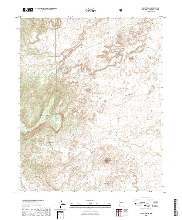
2023 Map of Cerro Tinaja
USGS Topo · Published 2023About this map
Cibola National Forest encompasses the western portion of this landscape, characterized by dramatic topographical shifts from high plateaus like Black Mesa to deep arroyo systems. The terrain is defined by a network of named canyons and water sources essential to this arid environment, including Rancho Viejo Spring and Jaralosa Spring. High points such as Cerro Tinaja and Cerro de Nuestra Señora provide orientation across the varied elevations. The land is marked by traditional Spanish-named landforms like Banco de la Casa, Cañada Ancha, and Mesita Leon, reflecting the deep cultural history of Sandoval County. Human presence is light, primarily represented by Co RD 279, which navigates the complex system of drainages like Badlands Canyon and Hay Meadow Canyon as they carve through the high desert floor.
Find a feature on this map
27 named features on this map. Tap any name to fly to it.
Don’t see what you’re looking for? This feature index may not catch every label — zoom into the map to look around manually.
Map Details
Editions of this 2023 Cerro Tinaja Map
This is the sole edition of this map. No revisions or reprints were ever made.
Other maps of this area

1883 · Mt. Taylor
USGS Topo · 1:250,000

1886 · Mt. Taylor
USGS Topo · 1:250,000

1892 · Mt. Taylor
USGS Topo · 1:250,000

1899 · Mt. Taylor
USGS Topo · 1:250,000

1958 · Albuquerque
USGS Topo · 1:250,000

1961 · Marquez
USGS Topo · 1:24,000

1961 · Cerro Parido
USGS Topo · 1:24,000

1961 · Cerro Tinaja
USGS Topo · 1:24,000
1961 · La Gotera
USGS Topo · 1:24,000
1961 · Puerco Dam
USGS Topo · 1:24,000