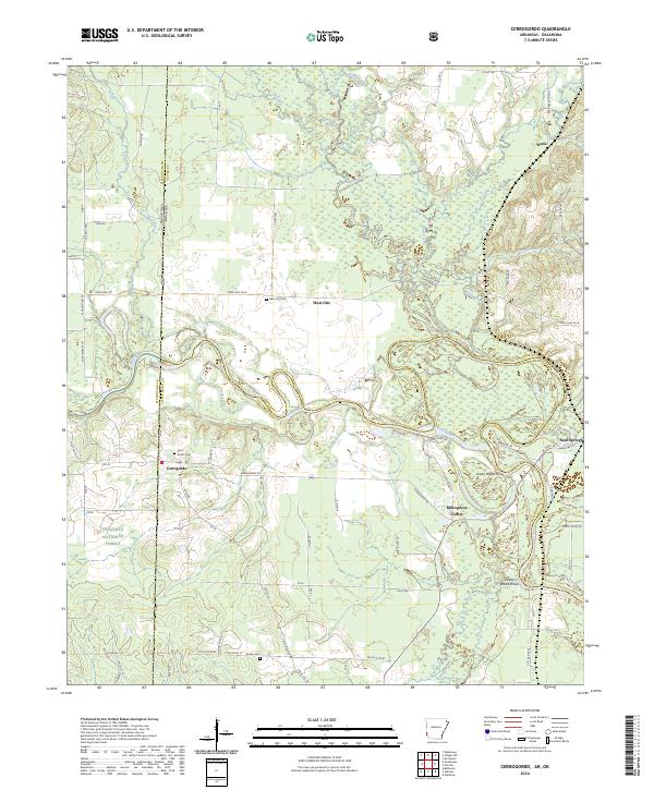
2024 Map of Cerrogordo
USGS Topo · Published 2024About this map
The Little River meanders sharply through the heart of this landscape, forming the natural border between Sevier and Little River counties. Along its winding course, historical crossing points and riverbank landmarks like Green Wood Ferry and Green Wood Shoals indicate the area's long reliance on water for transit and trade. The settlement of Cerrogordo sits near the state line, accompanied by the Cerro Gordo Cem, while other small communities such as Billingsleys Corner and West Otis are scattered across the surrounding grid. Large portions of the map are dedicated to conservation and public lands, including the southern reaches of the Ouachita National Forest and the wetland ecosystems of the Pond Creek National Wildlife Refuge. Tracing the varied road network from State Hwy 24 W to local routes like Pauley Cem Rd reveals a rural landscape where family-named landmarks and small cemeteries persist as anchors for local genealogy.
Find a feature on this map
71 named features on this map. Tap any name to fly to it.
Don’t see what you’re looking for? This feature index may not catch every label — zoom into the map to look around manually.
Map Details
Editions of this 2024 Cerrogordo Map
This is the sole edition of this map. No revisions or reprints were ever made.
Other maps of this area

1902 · Lukfata
USGS Topo · 1:125,000

1913 · De Queen
USGS Topo · 1:125,000

1950 · Mcalester
USGS Topo · 1:250,000

1950 · Winthrop
USGS Topo · 1:24,000

1950 · Goodwater
USGS Topo · 1:24,000

1950 · Bokhoma
USGS Topo · 1:24,000

1951 · Winthrop
USGS Topo · 1:24,000

1951 · Bokhoma
USGS Topo · 1:24,000

1951 · Goodwater
USGS Topo · 1:24,000

1951 · Arkinda
USGS Topo · 1:24,000