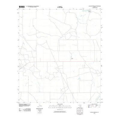
2010 Map of Chacon Creek NE
USGS Topo · Published 2010About this map
Chaparrosa Creek and its various tributaries define this ranching landscape in southern Texas, where water management is central to the land's utility. The presence of the Griffin Cattle Company Lake and the associated Griffin Cattle Company Lake Dam in the northern section highlights the industrial-scale agricultural operations of the Griffin Cattle Company. This network of seasonal waterways, including Dinner Creek, Polo Blanco Creek, and Mula Creek, illustrates the drainage patterns across this Maverick County terrain. The inclusion of features like Finley Lake Dam further emphasizes the local reliance on earthen dams to capture runoff in an area characterized by intermittent flow and sparse permanent surface water.
Find a feature on this map
7 named features on this map. Tap any name to fly to it.
Don’t see what you’re looking for? This feature index may not catch every label — zoom into the map to look around manually.
Map Details
Editions of this 2010 Chacon Creek NE Map
This is the sole edition of this map. No revisions or reprints were ever made.
Other maps of this area

1896 · Brackett
USGS Topo · 1:125,000

1897 · Brackett
USGS Topo · 1:125,000

1898 · Uvalde
USGS Topo · 1:125,000

1899 · Uvalde
USGS Topo · 1:125,000

1939 · La Pryor
USGS Topo · 1:62,500

1940 · Chacon Creek
USGS Topo · 1:62,500

1949 · Cline
USGS Topo · 1:62,500

1953 · Crystal City
USGS Topo · 1:250,000

1954 · San Antonio
USGS Topo · 1:250,000

1955 · Crystal City
USGS Topo · 1:250,000