
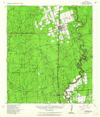
1939 Map of La Pryor
USGS Topo · Published 1958About this map
The Nueces River winds through the heart of Zavala County, anchoring a landscape of ranching and early transit in the late 1930s. The settlement of La Pryor serves as the primary hub, where the Gulf and Northern and San Antonio Uvalde and Gulf railroads intersect. This rail network facilitated the movement of goods from large cattle operations like the Chaparrosa Ranch and Mesteño Ranch to distant markets.
Find a feature on this map
42 named features on this map. Tap any name to fly to it.
Don’t see what you’re looking for? This feature index may not catch every label — zoom into the map to look around manually.
Map Details
Editions of this 1939 La Pryor Map
2 editions found
Other maps of this area

1896 · Brackett
USGS Topo · 1:125,000

1897 · Brackett
USGS Topo · 1:125,000

1898 · Uvalde
USGS Topo · 1:125,000

1899 · Uvalde
USGS Topo · 1:125,000

1939 · Carrizo Springs
USGS Topo · 1:62,500

1939 · Big Wells
USGS Topo · 1:62,500

1940 · Cometa
USGS Topo · 1:62,500

1940 · Chacon Creek
USGS Topo · 1:62,500

1949 · Cline
USGS Topo · 1:62,500

1953 · Crystal City
USGS Topo · 1:250,000