
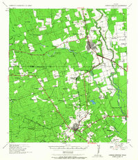
1939 Map of Carrizo Springs
USGS Topo · Published 1958About this map
Crystal City serves as the primary hub of this South Texas landscape, defined by an intensive network of ranching and early industrial agriculture. The presence of the State Experimental Station and the Wagner Dairy highlights the era's focus on land development, while the I-G N RR and various rail sidings like River Siding connected these remote operations to broader markets. The terrain is divided between large-scale operations like Rancho Grande and McKnight Ranch and smaller family-named holdings such as Giesler Farm and Williams Ranch.
Find a feature on this map
93 named features on this map. Tap any name to fly to it.
Don’t see what you’re looking for? This feature index may not catch every label — zoom into the map to look around manually.
Map Details
Editions of this 1939 Carrizo Springs Map
2 editions found
Other maps of this area

1929 · Cotulla
USGS Topo · 1:125,000

1932 · Valley Wells
USGS Topo · 1:62,500

1939 · Big Wells
USGS Topo · 1:62,500

1939 · La Pryor
USGS Topo · 1:62,500

1940 · Asherton
USGS Topo · 1:62,500

1940 · Catarina
USGS Topo · 1:62,500

1940 · Cometa
USGS Topo · 1:62,500

1940 · Chacon Creek
USGS Topo · 1:62,500

1941 · Botella Creek
USGS Topo · 1:62,500

1953 · Crystal City
USGS Topo · 1:250,000
Featured Places
- Crystal City, TX
- Carrizo Springs, TX
- Byrd, TX
- Amaya Colonia, TX
- La Hacienda Estates Number 2 Colonia, TX