
1940 Map of Asherton
USGS Topo · Published 1958About this map
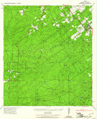
The town of Asheston serves as a small hub for the surrounding South Texas cattle country, situated along U.S. Route 83 during a time when ranching families shaped the geography of Dimmit County. This 1940 survey, published by the Corps of Engineers, reveals an extensive network of family-named ranching estates, including Brauer Ranch, San Pedro Ranch, and the Dulding Ranch. The landscape is defined by its drainages, where seasonal waters flow through Carrizo Creek, Pena Creek, and Moro Creek. For local historians and genealogists, the map preserves the exact locations of rural homesteads belonging to residents like Mrs. C. Bradshaw, Joe White, and Erskine Rhodes. The presence of the Dentonio School highlights the former center of a rural community that supported these outlying agricultural properties before larger-scale shifts in the region's ranching economy.
Find a feature on this map
69 named features on this map. Tap any name to fly to it.
Don’t see what you’re looking for? This feature index may not catch every label — zoom into the map to look around manually.
Map Details
Editions of this 1940 Asherton Map
2 editions found
Other maps of this area

1929 · Cotulla
USGS Topo · 1:125,000

1932 · Valley Wells
USGS Topo · 1:62,500

1939 · Carrizo Springs
USGS Topo · 1:62,500

1939 · Big Wells
USGS Topo · 1:62,500

1940 · Velenzuela Creek
USGS Topo · 1:62,500

1940 · San Loranzo Creek
USGS Topo · 1:62,500

1940 · Catarina
USGS Topo · 1:62,500

1940 · Cometa
USGS Topo · 1:62,500

1940 · Chupadera
USGS Topo · 1:62,500

1941 · Botella Creek
USGS Topo · 1:62,500