Old Maps of Dimmit County, Texas
Explore 209 old maps of Dimmit County, spanning from 1925 to today. These high-resolution historic maps reveal how streets, neighborhoods, landmarks, and natural features evolved over time — perfect for genealogy, metal detecting, research, and local history exploration.
What you can do with these maps:
- See how Dimmit County changed over time: Compare historical maps to modern-day views to trace roads, homesites, rail lines & more.
- View detailed metadata: Each map includes creators, publishers, year, scale, and archive source.
- Overlay maps with satellite & LiDAR: Visualize the past alongside modern tools to explore terrain & human change.
- Trusted historical sources: Maps sourced from the USGS, Library of Congress, and other archives.
- Access maps your way: View online, download high-res files, or order prints for personal or research use.
Start exploring old maps of Dimmit County to uncover forgotten places, hidden landmarks, and the deep history beneath your feet.
Dimmit County, TX maps
(209)- 1925 Map of San Roque Lake 1-a
 1925 San Roque Lake 1-a1925 Print · USGSDimmit County ranching and river life are captured here in the mid-twenties as the cattle industry shaped the South Texas brush country. Researchers can trace family-named outposts like Buckhorn Ranch and Rasmussen Ranch or follow the path of the Big Wells Road to Valley Wells.
 - 1927 Map of Bart
 1927 Bart1927 Print · USGSThe Dimmit and La Salle County line comes alive in the mid-twenties, centered on the winding Nueces River. Genealogists and local historians can trace early ranching footprints at Cochina Ranch, Wernberger Ranch, and San Roque Ranch.3 unique versions available
 - 1929 Map of Cotulla
 1929 Cotulla1929 Print · USGSThe South Texas brush country comes alive in the late 1920s, showing a landscape of massive cattle ranches and early rail outposts. Genealogists can trace family holdings from the Carlow Settlement to Valley Wells, or locate military sites like Dentonio.
 - 1932 Map of Valley Wells
 1932 Valley Wells1932 Print · USGSDimmit County ranching and water resources come into focus during the mid-1920s as the Nueces River valley undergoes formal surveying. Genealogists and historians can trace the early road networks and family holdings like Rasmussen Ranch, Buckhorn Ranch, and the settlement at Valley Wells.2 unique versions available
 - 1939 Map of Carrizo Springs, 1958 Print
 1939 Carrizo Springs1958 Print · USGSSouth Texas ranching and agriculture reach a peak in the late 1930s as irrigation and rail lines transformed the brush country. Genealogists can trace family holdings from Rancho Grande to Giesler Farm, or locate landmarks like the Hermann Sons Lodge.2 unique versions available
 - 1939 Map of Big Wells, 1958 Print
 1939 Big Wells1958 Print · USGSDimmit and Zavala counties are captured here just before World War II, showing a landscape defined by the railroad and large cattle ranches. Researchers can trace historic family holdings like the Snyder Ranch and transport hubs including Brundage and J. N. Siding.
 - 1940 Map of Asherton, 1958 Print
 1940 Asherton1958 Print · USGSSouth Texas ranching country comes into focus in this mid-century survey of Dimmit County as it appeared just before the war. Genealogists can trace family holdings and rural landmarks like the Dentonio School, Asheston, and the expansive Briscoe Ranch.2 unique versions available
 - 1940 Map of Velenzuela Creek, 1958 Print
 1940 Velenzuela Creek1958 Print · USGSSouth Texas ranching country at the start of the 1940s shows a landscape of expansive family holdings and seasonal creek beds. Researchers can locate specific sites like Velenzuela Ranch, the Hill Top Inn, and S Cotulla.2 unique versions available
 - 1940 Map of San Loranzo Creek, 1958 Print
 1940 San Loranzo Creek1958 Print · USGSThe ranching country of the Webb and Dimmit borderlands is captured here just before the mid-century, defined by scattered holdings and vital water tanks. Researchers can trace historic property boundaries and find locations like Brown Ranch, the Ruins site, and the Dos Hermanos Peaks.3 unique versions available
 - 1940 Map of Catarina, 1958 Print
 1940 Catarina1958 Print · USGSDimmit County ranching and rail infrastructure are captured here in the early 1940s, just as modern utilities reached the brush country. Genealogists can trace family holdings like the Buckhorn Ranch and Valley Wells along the Central and Gulf (Mo Pac) rail line.2 unique versions available
 - 1940 Map of Cometa, 1958 Print
 1940 Cometa1958 Print · USGSSouthwest Texas ranching country in the early nineteen-forties shows a landscape of large family holdings and seasonal creek beds. Genealogists can trace specific homesteads such as the Sullivan Ranch, F C Anglin Ranch, and the small settlement at Cometa.2 unique versions available
 - 1940 Map of Chupadera, 1959 Print
 1940 Chupadera1959 Print · USGSThe Texas-Mexico borderlands along the Rio Grande are captured here just before the war, showing the remote ranching country of Webb Co. Researchers can locate isolated water sources and early landmarks like Chupadera Ranch, Sullivan Spring, and Cathedral Rock.2 unique versions available
 - 1940 Map of Artesia Wells, 1959 Print
 1940 Artesia Wells1959 Print · USGSLa Salle and Dimmit Counties are captured here just before the Second World War, showing a ranching landscape defined by the Nueces River. Researchers can trace family homesteads like R Armstrong and J Henderson or follow the path of the International-Great Northern Railroad through Artesia Wells.
 - 1941 Map of Botella Creek
 1941 Botella Creek1941 Print · USGSThe Maverick and Dimmit county lines meet in this brush-country landscape during the early years of the Second World War. Researchers can trace the heritage of remote family outposts like Tovar Ranch and Red Ranch or locate vital water sources such as Indio Tank and Lopez Tank.
 - 1953 Map of Crystal City
 1953 Crystal City1953 Print · USGSSouth Texas in the early fifties was a landscape of expanding oil fields and vital rail connections. Genealogists and researchers can trace family lands along the Nueces River or locate heritage sites in Asherton, Big Wells, and Batesville.
 - 1955 Map of Crystal City, 1976 Print
 1955 Crystal City1976 Print · USGSSouth Texas ranching and oil country come into focus in the mid-fifties as the rail lines and rivers connect growing hubs. Researchers can trace the development of energy fields like Washburn Oil Field or locate historic settlements from Asherton to Three Rivers.
 - 1956 Map of Woodward
 1956 Woodward1956 Print · USGSMid-century ranching and rail life dominate the South Texas borderlands where four counties meet. Genealogists and historians can trace family holdings like Vesper Ranch or El Cid Ranch and locate the rail stop at Woodward.
 - 1957 Map of Encinal
 1957 Encinal1957 Print · USGSThe South Texas brush country around the Webb and La Salle county lines is captured here during a period of established ranching and rail commerce. Family historians can trace numerous homesteads and landmarks like Prairie View School, Bell Ranch, and Atlee Siding.
 - 1957 Map of Botella Creek
 1957 Botella Creek1957 Print · USGSSouth Texas ranching country at the mid-century reveals a landscape dependent on isolated water tanks and family-run spreads. Genealogists can trace property names like Glass Ranch, Red Ranch, and landmarks such as Mc Furland Tank.
 - 1958 Map of Eagle Pass, 1969 Print
 1958 Eagle Pass1969 Print · USGSThe borderlands of South Texas come alive in this mid-century look at the ranching and rail corridor along the Rio Grande. Genealogists and historians can trace legacy holdings like San Pedro Ranch, find the Maverick Canal network, and locate rail sidings at Darling.2 unique versions available
 - 1961 Map of Crystal City
 1961 Crystal City1961 Print · USGSSouth Texas in the early sixties reveals a landscape of massive cattle ranches and emerging oil fields. Genealogists and historians can trace the Missouri Pacific rail lines through Crystal City, or locate water features like Espantosa Lake and Boynton Reservoir.
 - 1965 Map of Eagle Pass
 1965 Eagle Pass1965 Print · USGSThe Texas-Mexico borderlands come into focus in the mid-1960s, centered on the river life and ranching culture of Maverick County. Researchers can trace the legacy of major landholdings like Burr Ranch and Loma Linda Ranch alongside landmarks like the Hydroelectric Plant.
 - 1968 Map of Crystal City
 1968 Crystal City1968 Print · USGSSouth Texas in the late sixties reveals a landscape shaped by ranching roots and the vital waters of the Nueces River. Researchers can trace the rail-driven growth of Crystal City or locate landmarks like Pilot Knob and Espantosa Lake.
 - 1972 Map of Big Wells, 1974 Print
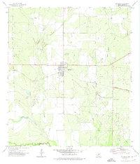 1972 Big Wells1974 Print · USGSBig Wells was a bustling rail-and-petroleum hub in South Texas during the early seventies. Genealogists and researchers can trace local family landmarks like the Big Wells Cem and St Michaels Cem or follow the path of the Missouri Pacific railroad.
 - 1972 Map of Carrizo Springs NW, 1974 Print
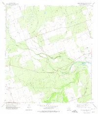 1972 Carrizo Springs NW1974 Print · USGSZavala County ranching and oil territory are documented here in the early seventies, showing a landscape of seasonal creeks and petroleum production. Researchers can locate the small settlement at Rutledge, trace the bends of Fishhook Lake, or identify old Oil Wells.
Showing maps 1-25 of 209
Top cities of Dimmit County
- Carrizo Springs historical maps
- Asherton historical maps
- Big Wells historical maps
- Catarina historical maps
Frequently asked questions
- What are the different types of historical maps available for Dimmit County?
- What is the oldest map of Dimmit County?
- Where can I purchase historical maps of Dimmit County for my home or office?
- Where can I download high-res historical maps of Dimmit County?
- Are there historical topographic maps available for Dimmit County?
- Is there historical aerial imagery available for Dimmit County?
- Where are historical maps of Dimmit County sourced from?