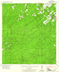
1940 Map of Asherton
USGS Topo · Published 1961About this map
The brush country of Dimmit County comes into sharp focus during the 1940s, a period when this landscape was defined by an extensive network of large family ranches and rural outposts. Asherton serves as the primary hub, showing the town's layout and surrounding agricultural tracts like Eardly Farm and Hardy Corp. The map is particularly valuable for its documentation of individual property owners and ranch names, including the San Pedro Ranch, Brauer Ranch, and the holdings of Mrs C Bradshaw and J Jones.
Find a feature on this map
48 named features on this map. Tap any name to fly to it.
Don’t see what you’re looking for? This feature index may not catch every label — zoom into the map to look around manually.
Map Details
Editions of this 1940 Asherton Map
2 editions found
Other maps of this area

1929 · Cotulla
USGS Topo · 1:125,000

1932 · Valley Wells
USGS Topo · 1:62,500

1939 · Carrizo Springs
USGS Topo · 1:62,500

1939 · Big Wells
USGS Topo · 1:62,500

1940 · Asherton
USGS Topo · 1:62,500

1940 · Velenzuela Creek
USGS Topo · 1:62,500

1940 · San Loranzo Creek
USGS Topo · 1:62,500

1940 · Catarina
USGS Topo · 1:62,500

1940 · Cometa
USGS Topo · 1:62,500

1940 · Chupadera
USGS Topo · 1:62,500