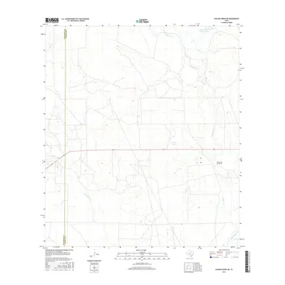
2016 Map of Chacon Creek NE
USGS Topo · Published 2016About this map
The Maverick and Zavala County border defines the western edge of this South Texas landscape, where the ephemeral drainage systems of the Rio Grande basin carve through the brush country. Significant water storage is represented by the Griffin Cattle Company Lake in the north and Finley Lake central to the quadrangle, indicating the region's reliance on managed water resources for ranching. The terrain is a network of interlocking seasonal streams, including the prominent Chaparrosa Cr and the winding Palo Blanco Cr. These waterways, along with the Arroyo de San Lucas, follow the natural contours of the land, reflecting the traditional ranching boundaries and land-use patterns that have persisted in this part of Maverick County into the early twenty-first century.
Find a feature on this map
9 named features on this map. Tap any name to fly to it.
Don’t see what you’re looking for? This feature index may not catch every label — zoom into the map to look around manually.
Map Details
Editions of this 2016 Chacon Creek NE Map
This is the sole edition of this map. No revisions or reprints were ever made.
Other maps of this area

1896 · Brackett
USGS Topo · 1:125,000

1897 · Brackett
USGS Topo · 1:125,000

1898 · Uvalde
USGS Topo · 1:125,000

1899 · Uvalde
USGS Topo · 1:125,000

1939 · La Pryor
USGS Topo · 1:62,500

1940 · Chacon Creek
USGS Topo · 1:62,500

1949 · Cline
USGS Topo · 1:62,500

1953 · Crystal City
USGS Topo · 1:250,000

1954 · San Antonio
USGS Topo · 1:250,000

1955 · Crystal City
USGS Topo · 1:250,000