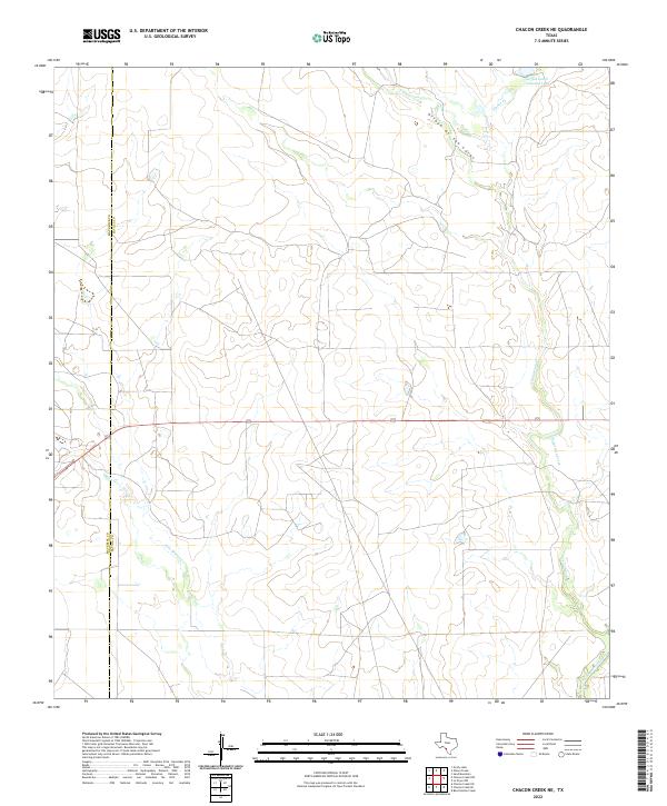
2022 Map of Chacon Creek NE
USGS Topo · Published 2022About this map
The boundary between Maverick Co and Zavala Co cuts vertically through this South Texas landscape, defined by a complex network of seasonal drainages and cattle ranching infrastructure. Water management is central to the area's geography, anchored by the Griffin Cattle Company Lake in the northeastern reaches. This water source feeds into a series of interconnected arroyos and creeks, including Arroyo de San Lucas and Dinner Cr, which carve through the arid terrain. The primary transit artery, Highway 57, bisects the center of the sheet, providing a straight path across the winding paths of Chaparrosa Creek and Mula Cr. The landscape is characterized by its drainage patterns, with Palo Blanco Cr further south illustrating the importance of natural watersheds in this ranching region.
Find a feature on this map
9 named features on this map. Tap any name to fly to it.
Don’t see what you’re looking for? This feature index may not catch every label — zoom into the map to look around manually.
Map Details
Editions of this 2022 Chacon Creek NE Map
This is the sole edition of this map. No revisions or reprints were ever made.
Other maps of this area

1896 · Brackett
USGS Topo · 1:125,000

1897 · Brackett
USGS Topo · 1:125,000

1898 · Uvalde
USGS Topo · 1:125,000

1899 · Uvalde
USGS Topo · 1:125,000

1939 · La Pryor
USGS Topo · 1:62,500

1940 · Chacon Creek
USGS Topo · 1:62,500

1949 · Cline
USGS Topo · 1:62,500

1953 · Crystal City
USGS Topo · 1:250,000

1954 · San Antonio
USGS Topo · 1:250,000

1955 · Crystal City
USGS Topo · 1:250,000