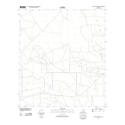
2010 Map of Chacon Creek NW
USGS Topo · Published 2010About this map
Salado Creek and Elm Creek converge in this corner of Maverick County, where the dry landscape of South Texas is defined by a dendritic network of seasonal waterways. The map illustrates a rural ranching environment where modern transportation corridors like Highway 57 and FM 481 cut across the natural drainages of Chacon Creek and Palo Blanco Creek. Researchers will note the sparse distribution of permanent structures, reflecting a land use pattern dominated by large-scale landholdings and watershed management. The presence of named geographic markers such as Buck Hollow and Mula Creek provide specific landmarks for tracing historical property boundaries and grazing routes in a region where water access historically dictated the location of camps and settlements.
Find a feature on this map
8 named features on this map. Tap any name to fly to it.
Don’t see what you’re looking for? This feature index may not catch every label — zoom into the map to look around manually.
Map Details
Editions of this 2010 Chacon Creek NW Map
This is the sole edition of this map. No revisions or reprints were ever made.
Other maps of this area

1896 · Brackett
USGS Topo · 1:125,000

1897 · Brackett
USGS Topo · 1:125,000

1940 · Paloma
USGS Topo · 1:62,500

1940 · Chacon Creek
USGS Topo · 1:62,500

1944 · Spofford
USGS Topo · 1:62,500

1949 · Cline
USGS Topo · 1:62,500

1958 · Eagle Pass
USGS Topo · 1:250,000

1958 · Del Rio
USGS Topo · 1:250,000

1964 · Del Rio
USGS Topo · 1:250,000

1965 · Eagle Pass
USGS Topo · 1:250,000