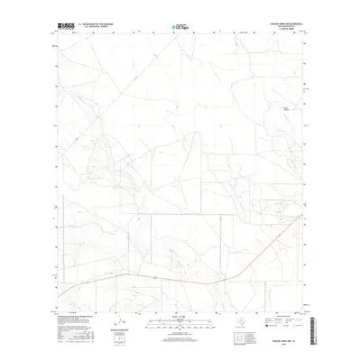
2016 Map of Chacon Creek NW
USGS Topo · Published 2016About this map
The arid ranching country of Maverick County is defined here by a network of seasonal drainages that converge as they head toward the Rio Grande valley. The most significant of these is Elm Cr, which meanders south through the western half of the terrain, joined by the waters of Salado Cr. This 2016 survey captures a landscape of cattle guards and fencelines, where the sparse human footprint is largely confined to FM 481 and a web of private ranch roads. To the east, the topography transitions into the subtle depressions of Buck Hollow and the headwaters of Palo Blanco Cr and Mula Cr. The map illustrates how local geography and water access dictate the layout of this South Texas brush country, with Chacon Cr clipping the southern boundary.
Find a feature on this map
7 named features on this map. Tap any name to fly to it.
Don’t see what you’re looking for? This feature index may not catch every label — zoom into the map to look around manually.
Map Details
Editions of this 2016 Chacon Creek NW Map
This is the sole edition of this map. No revisions or reprints were ever made.
Other maps of this area

1896 · Brackett
USGS Topo · 1:125,000

1897 · Brackett
USGS Topo · 1:125,000

1940 · Paloma
USGS Topo · 1:62,500

1940 · Chacon Creek
USGS Topo · 1:62,500

1944 · Spofford
USGS Topo · 1:62,500

1949 · Cline
USGS Topo · 1:62,500

1958 · Eagle Pass
USGS Topo · 1:250,000

1958 · Del Rio
USGS Topo · 1:250,000

1964 · Del Rio
USGS Topo · 1:250,000

1965 · Eagle Pass
USGS Topo · 1:250,000