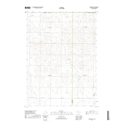
2017 Map of Chadron NE
USGS Topo · Published 2017About this map
The White River flows across the northern reaches of this landscape where the high plains of the Dawes and Sheridan county lines meet. This rural corridor is defined by the drainage basins of Beaver Cr and Limekiln Cr, with the Isham Reservoir providing a focal point for local water management in a region dominated by ranching and open range. The topography is marked by the transition from the river valley to the elevated terrain accessed by Slim Butte Rd and Slim Buttes Rd. Near the southern border, the Beaver Valley Cem serves as a significant genealogical landmark, situated along Beaver Valley Rd and the 710 Rd. The map illustrates a network of section lines and trails, such as 720th Trl, that underscore the enduring spatial organization of this borderland territory.
Find a feature on this map
18 named features on this map. Tap any name to fly to it.
Don’t see what you’re looking for? This feature index may not catch every label — zoom into the map to look around manually.
Map Details
Editions of this 2017 Chadron NE Map
This is the sole edition of this map. No revisions or reprints were ever made.
Other maps of this area

1955 · Hot Springs
USGS Topo · 1:250,000

1955 · Alliance
USGS Topo · 1:250,000

1957 · Alliance
USGS Topo · 1:250,000

1958 · Alliance
USGS Topo · 1:250,000

1967 · Pine Ridge SW
USGS Topo · 1:24,000

1967 · Slim Butte SW
USGS Topo · 1:24,000

1967 · Slim Butte
USGS Topo · 1:24,000

1969 · Beaver Wall
USGS Topo · 1:24,000

1969 · Chadron NE
USGS Topo · 1:24,000

1969 · Bordeaux
USGS Topo · 1:24,000