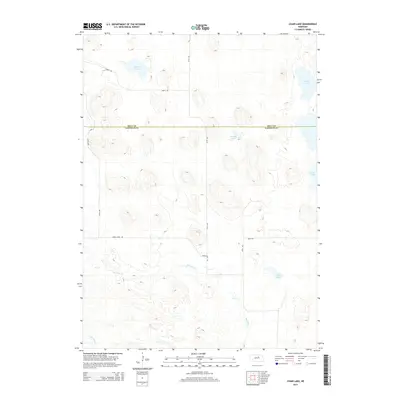
2014 Map of Chain Lake
USGS Topo · Published 2014About this map
The Nebraska Sandhills landscape is defined by its distinctive hydrology across the border of Holt and Garfield counties. This modern topographic study reveals a complex system of semi-permanent water bodies, including the central Chain Lake and the nearby Rush Lake. These lakes are vital components of the region's unique wetland ecology, fed by high groundwater levels and seasonal drainage. The southern portion of the map traces the headwaters of the Big Cedar Creek and Little Cedar Creek, which carve through the dune formations. Human infrastructure is limited to a sparse grid of section roads like 848th Road and 474th Avenue, illustrating the vast, unpopulated nature of these ranchlands. The orientation of roads such as Cedar River Road indicates the primary routes used to navigate this terrain between isolated ranching outposts.
Find a feature on this map
14 named features on this map. Tap any name to fly to it.
Don’t see what you’re looking for? This feature index may not catch every label — zoom into the map to look around manually.
Map Details
Editions of this 2014 Chain Lake Map
This is the sole edition of this map. No revisions or reprints were ever made.
Other maps of this area

1952 · Burwell NE
USGS Topo · 1:24,000

1954 · Gables NW
USGS Topo · 1:24,000

1954 · Gables
USGS Topo · 1:24,000

1955 · Broken Bow
USGS Topo · 1:250,000

1955 · O'Neill
USGS Topo · 1:250,000

1956 · Broken Bow
USGS Topo · 1:250,000

1959 · O'Neill
USGS Topo · 1:250,000

1969 · O'Neill
USGS Topo · 1:250,000
1981 · Abbott Ranch
USGS Topo · 1:24,000

1981 · Swan Lake
USGS Topo · 1:24,000