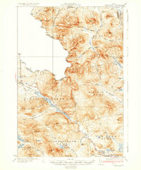
1935 Map of Chain Lakes
USGS Topo · Published 1935About this map
The Arnold Route No 4 Trail traces a historic passage through the Maine wilderness along the Chain Lakes, following the path of Arnold Stream toward the border. This 1935 edition captures a landscape defined by seasonal camps and logging infrastructure, with Moose Mill Camp and Caribou Camp situated along the mountain brooks. The map documents the strategic network of fire detection in this heavily forested region, featuring the Snow Mtn Fire Tower and Kibby Fire Tower on their respective peaks. Notable family or localized landmarks like Ben Dewitt Camp and Upper Farm indicate the sparse but established human presence in townships like Kibby and Alder Stream. The rugged terrain of Kibby Mountain and Mt Pisgah serves as the backdrop for a network of trails and brooks that fed the regional timber and water systems.
Find a feature on this map
87 named features on this map. Tap any name to fly to it.
Don’t see what you’re looking for? This feature index may not catch every label — zoom into the map to look around manually.
Map Details
Editions of this 1935 Chain Lakes Map
4 editions found

Other maps of this area

1923 · Attean
USGS Topo · 1:62,500

1925 · Attean
USGS Topo · 1:62,500

1928 · Chain Lakes
USGS Topo · 1:48,000

1928 · Skinner
USGS Topo · 1:48,000

1928 · Spencer
USGS Topo · 1:48,000

1928 · Stratton
USGS Topo · 1:48,000

1931 · Cupsuptic
USGS Topo · 1:48,000

1931 · Skinner
USGS Topo · 1:62,500

1932 · Stratton
USGS Topo · 1:62,500

1932 · Kennebago Lake
USGS Topo · 1:48,000