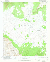
1970 Map of Chaiyahi Rim NE
USGS Topo · Published 1973About this map
Navajo Mtn and the sweeping Chaiyahi Rim anchor this high-desert landscape within the Navajo Indian Reservation. This 1970 field-checked survey reveals a sparsely settled region defined by essential water sources and ancient sites, including a Cliff Dwelling and Red House located along the northern slopes. The mapping of The Old Windmill and various Water Tanks highlights the critical infrastructure required for life and livestock in this arid territory at the intersection of Coconino and Navajo Counties.
Find a feature on this map
15 named features on this map. Tap any name to fly to it.
Don’t see what you’re looking for? This feature index may not catch every label — zoom into the map to look around manually.
Map Details
Editions of this 1970 Chaiyahi Rim NE Map
This is the sole edition of this map. No revisions or reprints were ever made.
Other maps of this area

1883 · Marsh Pass
USGS Topo · 1:250,000

1886 · Henry Mountains
USGS Topo · 1:250,000

1892 · Marsh Pass
USGS Topo · 1:250,000

1892 · Henry Mountains
USGS Topo · 1:250,000

1953 · Navajo Mountain 4 SW
USGS Topo · 1:24,000

1953 · Navajo Mountain
USGS Topo · 1:62,500

1953 · No Mans Mesa
USGS Topo · 1:62,500

1956 · Escalante
USGS Topo · 1:250,000

1956 · Marble Canyon
USGS Topo · 1:250,000

1959 · Marble Canyon
USGS Topo · 1:250,000