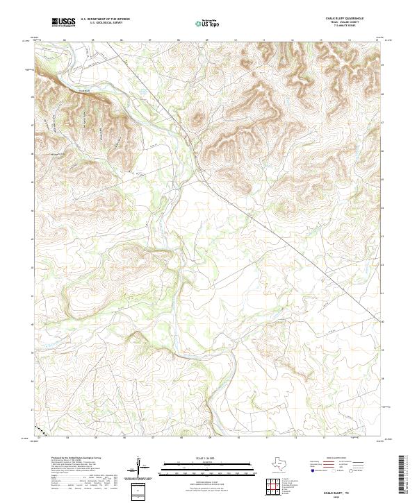
2022 Map of Chalk Bluff
USGS Topo · Published 2022About this map
The Nueces River winds through this Texas landscape, marked by the prominent geological formation at Chalk Bluff. The drainage patterns here are complex, defined by numerous seasonal draws such as Perfecto Mata Draw and Bee Apiary Draw that feed into the river valley. The confluence of the W Nueces River and the main stem occurs in a region dominated by ranch roads and cattle-country infrastructure like Windmill Draw. Significant water sources like Spring Branch Springs and Elm Slough highlight the hydrologic importance of this arid region. The network of private and county roads, including Chalk Bluff Rd and Louis Ln, provides access to these isolated draws and creek beds, illustrating the modern rural layout of northern Uvalde County.
Find a feature on this map
27 named features on this map. Tap any name to fly to it.
Don’t see what you’re looking for? This feature index may not catch every label — zoom into the map to look around manually.
Map Details
Editions of this 2022 Chalk Bluff Map
This is the sole edition of this map. No revisions or reprints were ever made.
Other maps of this area

1896 · Brackett
USGS Topo · 1:125,000

1897 · Brackett
USGS Topo · 1:125,000

1898 · Uvalde
USGS Topo · 1:125,000

1899 · Uvalde
USGS Topo · 1:125,000

1938 · Turkey Mountain
USGS Topo · 1:48,000

1943 · Turkey Mountain
USGS Topo · 1:62,500

1949 · Cline
USGS Topo · 1:62,500

1954 · San Antonio
USGS Topo · 1:250,000

1957 · San Antonio
USGS Topo · 1:250,000

1958 · Del Rio
USGS Topo · 1:250,000