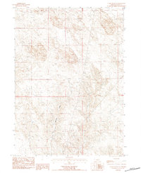
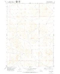
1983 Map of Chalk Buttes NE
USGS Topo · Published 1984About this map
Dry Spottetail Creek meanders through this arid corner of Sioux County, Nebraska, where the landscape is defined by its drainage patterns and resource extraction. Surveyed in the early 1980s, the map illustrates a sparsely settled region focused on utility and ranching infrastructure. A Gravel Pit indicates local industry, while a Radio Tower and Wooden Steel Tower stand as distinctive landmarks on the higher elevations. The presence of an Irr Well in the northern section highlights the critical role of groundwater management for agriculture in this semi-arid environment. This provisional survey captures the transition between open range and managed terrain, marked by the fine-grained topographical detail of the surrounding bluffs and extensive areas of Sand.
Find a feature on this map
9 named features on this map. Tap any name to fly to it.
Don’t see what you’re looking for? This feature index may not catch every label — zoom into the map to look around manually.
Map Details
Editions of this 1983 Chalk Buttes NE Map
This is the sole edition of this map. No revisions or reprints were ever made.
Other maps of this area

1899 · Whistle Creek
USGS Topo · 1:125,000

1955 · Alliance
USGS Topo · 1:250,000

1957 · Alliance
USGS Topo · 1:250,000

1958 · Alliance
USGS Topo · 1:250,000

1963 · Chalk Buttes
USGS Topo · 1:24,000
1963 · Erdman Ranch
USGS Topo · 1:24,000
1963 · Dry Sheep Creek
USGS Topo · 1:24,000
1963 · University Lake
USGS Topo · 1:24,000

1979 · Mount Edna
USGS Topo · 1:24,000
1979 · Agate SW
USGS Topo · 1:24,000