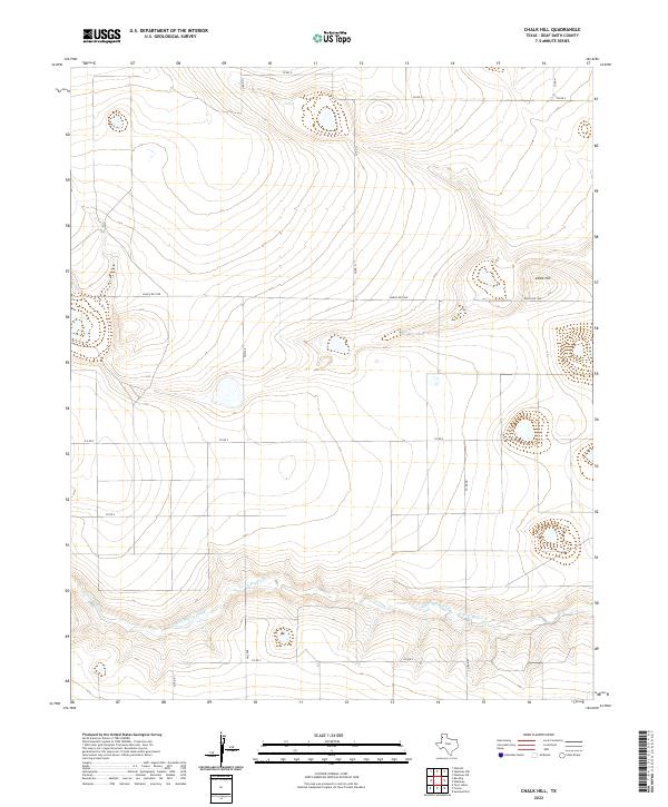
2022 Map of Chalk Hill
USGS Topo · Published 2022About this map
Tierra Blanca Creek carves a distinct path through this High Plains landscape in Deaf Smith County, defining the local hydrology as it flows toward the east. The terrain is characterized by broad plateaus and intermittent depressions, punctuated by the modest rise of Chalk Hill in the northeastern quadrant. This 2022 survey illustrates a sparsely populated agricultural environment organized by an orderly grid of rural transport routes. Major thoroughfares like Ranch Rd 1058 and FM 2298 facilitate movement across the panhandle, connecting various section roads including Co Rd 9 and Co Rd 5. The drainage patterns surrounding Tierra Blanca Cr and its associated basins reflect the geographic character of this region, where the flat topography is primarily managed for ranching and large-scale farming.
Find a feature on this map
14 named features on this map. Tap any name to fly to it.
Don’t see what you’re looking for? This feature index may not catch every label — zoom into the map to look around manually.
Map Details
Editions of this 2022 Chalk Hill Map
This is the sole edition of this map. No revisions or reprints were ever made.
Other maps of this area

1954 · Clovis
USGS Topo · 1:250,000

1958 · Clovis
USGS Topo · 1:250,000

1965 · Twin Lakes
USGS Topo · 1:24,000

1966 · Friona
USGS Topo · 1:24,000

1966 · Summerfield
USGS Topo · 1:24,000

1970 · Chalk Hill
USGS Topo · 1:24,000

1971 · Westway
USGS Topo · 1:24,000

1971 · Bootleg
USGS Topo · 1:24,000
1971 · Westway NW
USGS Topo · 1:24,000
1971 · Walcott
USGS Topo · 1:24,000