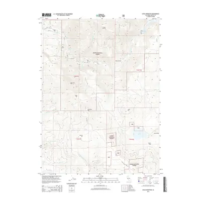
2015 Map of Chalk Mountain
USGS Topo · Published 2015About this map
Pit River carves a dramatic path through this high-country landscape, where the boundaries of the Shasta National Forest and Lassen National Forest meet. The 2015 topography reveals a complex network of ridges and drainage basins, including the notable Pit Four Reservoir in the northeast and high-elevation waters like Lake Margaret to the southeast. Isolated settlements and outposts such as Hagen Flat, Bee Knoll, and Oak Flat are situated among prominent peaks like Chalk Mountain, Hatchet Mtn, and Bales Mtn. The map documents significant terrain features such as the Deep Creek Slide and Malinda Gulch, reflecting the active geomorphology of the region. This survey serves as a precise record of timberland access via Baker Rd and Bunch Grass Lookout Rd during the early 21st century.
Find a feature on this map
41 named features on this map. Tap any name to fly to it.
Don’t see what you’re looking for? This feature index may not catch every label — zoom into the map to look around manually.
Map Details
Editions of this 2015 Chalk Mountain Map
This is the sole edition of this map. No revisions or reprints were ever made.
Other maps of this area

1886 · Lassen Peak
USGS Topo · 1:250,000

1886 · Modoc Lava Bed
USGS Topo · 1:250,000

1892 · Modoc Lava-Bed
USGS Topo · 1:250,000

1892 · Lassen Peak
USGS Topo · 1:250,000

1894 · Lassen Peak
USGS Topo · 1:250,000

1932 · Bartle
USGS Topo · 1:96,000

1935 · Burney
USGS Topo · 1:96,000

1939 · Burney
USGS Topo · 1:125,000

1939 · Bartle
USGS Topo · 1:125,000

1954 · Alturas
USGS Topo · 1:250,000