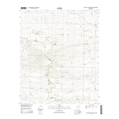
2014 Map of Chalybeate Mountain West
USGS Topo · Published 2014About this map
The Antoine River carves a winding path through this corner of southwestern Arkansas, serving as a natural boundary between Clark and Pike counties. The landscape is defined by its rural settlements and historical road networks, including the venerable Military Rd in the southeastern quadrant. The topography transitions from the heights of Chalybeate Mountain and Round Top Mtn down into the Chalybeate Valley, where timber and small-scale agriculture have long shaped the local economy.
Find a feature on this map
109 named features on this map. Tap any name to fly to it.
Don’t see what you’re looking for? This feature index may not catch every label — zoom into the map to look around manually.
Map Details
Editions of this 2014 Chalybeate Mountain West Map
This is the sole edition of this map. No revisions or reprints were ever made.
Other maps of this area

1906 · Caddo Gap
USGS Topo · 1:125,000

1936 · Glenwood
USGS Topo · 1:48,000

1942 · Glenwood
USGS Topo · 1:62,500

1943 · Antoine
USGS Topo · 1:62,500

1949 · Glenwood
USGS Topo · 1:62,500

1955 · Little Rock
USGS Topo · 1:250,000

1956 · Little Rock
USGS Topo · 1:250,000

1960 · Little Rock
USGS Topo · 1:250,000

1964 · Little Rock
USGS Topo · 1:250,000
1966 · Point Cedar
USGS Topo · 1:24,000