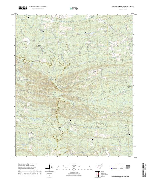
2024 Map of Chalybeate Mountain West
USGS Topo · Published 2024About this map
The Antoine River winds through the borderlands of Pike and Clark counties, defining a landscape marked by small rural settlements and numerous family-held burial grounds. This modern survey illustrates the enduring patterns of communities like Majors, Nutts, and Shawmut, while highlighting the elevated terrain of Chalybeate Mountain and Round Top Mtn. The map is particularly useful for genealogical research, identifying numerous remote cemeteries including Osborn Cem, Friendship Cem, and Bethsaida Cem. To the south, the site of Graysonia sits along the river, providing a point of reference for researchers tracing the history of the regional timber industry. The network of county roads and forest trails connects these historically significant locales with water features like Mathews Creek and the Terre Noire Creek, reflecting the traditional reliance on the area's river valleys and ridgelines.
Find a feature on this map
100 named features on this map. Tap any name to fly to it.
Don’t see what you’re looking for? This feature index may not catch every label — zoom into the map to look around manually.
Map Details
Editions of this 2024 Chalybeate Mountain West Map
This is the sole edition of this map. No revisions or reprints were ever made.
Other maps of this area

1906 · Caddo Gap
USGS Topo · 1:125,000

1936 · Glenwood
USGS Topo · 1:48,000

1942 · Glenwood
USGS Topo · 1:62,500

1943 · Antoine
USGS Topo · 1:62,500

1949 · Glenwood
USGS Topo · 1:62,500

1955 · Little Rock
USGS Topo · 1:250,000

1956 · Little Rock
USGS Topo · 1:250,000

1960 · Little Rock
USGS Topo · 1:250,000

1964 · Little Rock
USGS Topo · 1:250,000
1966 · Point Cedar
USGS Topo · 1:24,000