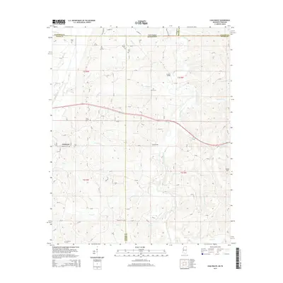
2015 Map of Chalybeate
USGS Topo · Published 2015About this map
The settlement of Chalybeate lies in a landscape defined by the drainage systems of the Hatchie River and its numerous tributaries at the border of Mississippi and Tennessee. This 2015 survey reveals a terrain of significant genealogical interest, dotted with historic burial grounds including State Line Cem, Bethel Cem, and Harden Cem along the northern boundary. The intricate network of creeks, such as Bearman Cr and Jonesboro Cr, highlights the importance of localized crossings like Lookout Bridge and Crum Bridge. Moving south into the Hatchie Hills, the density of names like Ebenezer Cem and Providence Cem suggests long-established community centers centered around family churches and homesteads. The map provides a clear view of the rural road system, connecting these landmarks across Tippah, Alcorn, Hardeman, and McNairy counties.
Find a feature on this map
118 named features on this map. Tap any name to fly to it.
Don’t see what you’re looking for? This feature index may not catch every label — zoom into the map to look around manually.
Map Details
Editions of this 2015 Chalybeate Map
This is the sole edition of this map. No revisions or reprints were ever made.
Other maps of this area

1950 · Corinth
USGS Topo · 1:62,500

1950 · Pocahontas
USGS Topo · 1:24,000

1950 · Middleton
USGS Topo · 1:24,000

1951 · Middleton
USGS Topo · 1:24,000

1951 · Chewalla
USGS Topo · 1:24,000

1951 · Walnut
USGS Topo · 1:62,500

1952 · Pocahontas
USGS Topo · 1:24,000

1956 · Blytheville
USGS Topo · 1:250,000

1956 · Tupelo
USGS Topo · 1:250,000

1958 · Tupelo
USGS Topo · 1:250,000