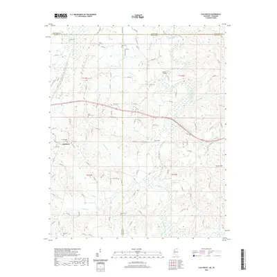
2020 Map of Chalybeate
USGS Topo · Published 2020About this map
Chalybeate serves as the primary settlement center within this borderland landscape where Mississippi meets Tennessee. The terrain is defined by the winding course of the Hatchie River and the elevations of the Hatchie Hills, a region characterized by numerous small drainages like Mathis Cr and Jonesboro Cr. For genealogists, the map is remarkably dense with family-named landmarks and burial grounds, including the Chalybeate Cem, Camp Ground Cem, and Providence Cem, which are scattered throughout the rural landscape. This modern survey reflects a settlement pattern of small clusters and crossroads connected by an extensive network of county roads. Industrial and transport history is represented by infrastructure crossing the river wetlands, such as Lookout Bridge and Crum Bridge, which facilitate travel through the bottomlands between the higher ridges.
Find a feature on this map
116 named features on this map. Tap any name to fly to it.
Don’t see what you’re looking for? This feature index may not catch every label — zoom into the map to look around manually.
Map Details
Editions of this 2020 Chalybeate Map
This is the sole edition of this map. No revisions or reprints were ever made.
Other maps of this area

1950 · Corinth
USGS Topo · 1:62,500

1950 · Pocahontas
USGS Topo · 1:24,000

1950 · Middleton
USGS Topo · 1:24,000

1951 · Middleton
USGS Topo · 1:24,000

1951 · Chewalla
USGS Topo · 1:24,000

1951 · Walnut
USGS Topo · 1:62,500

1952 · Pocahontas
USGS Topo · 1:24,000

1956 · Blytheville
USGS Topo · 1:250,000

1956 · Tupelo
USGS Topo · 1:250,000

1958 · Tupelo
USGS Topo · 1:250,000