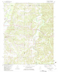
1982 Map of Chalybeate
USGS Topo · Published 1983About this map
Chalybeate lies near the center of a complex borderland where Tippah and Alcorn counties meet the Tennessee-Mississippi state line. This 1982 survey reveals a landscape of dispersed rural settlements and local institutions, such as Union Center Sch and Overton Hill Sch, which served the farming communities of the late twentieth century. The terrain is deeply carved by watercourses like the Hatchie River, Muddy Creek, and Hurricane Creek, which dictate the placement of roads and family-named landmarks.
Find a feature on this map
41 named features on this map. Tap any name to fly to it.
Don’t see what you’re looking for? This feature index may not catch every label — zoom into the map to look around manually.
Map Details
Editions of this 1982 Chalybeate Map
This is the sole edition of this map. No revisions or reprints were ever made.
Other maps of this area

1950 · Corinth
USGS Topo · 1:62,500

1950 · Pocahontas
USGS Topo · 1:24,000

1950 · Middleton
USGS Topo · 1:24,000

1951 · Middleton
USGS Topo · 1:24,000

1951 · Chewalla
USGS Topo · 1:24,000

1951 · Walnut
USGS Topo · 1:62,500

1952 · Pocahontas
USGS Topo · 1:24,000

1956 · Blytheville
USGS Topo · 1:250,000

1956 · Tupelo
USGS Topo · 1:250,000

1958 · Tupelo
USGS Topo · 1:250,000