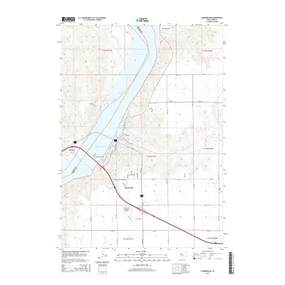
2015 Map of Chamberlain
USGS Topo · Published 2015About this map
The Missouri River and its widening into Lake Francis Case dominate this Missouri River landscape, serving as the primary geographic divide between Chamberlain in Brule County and Oacoma in Lyman County. The Lewis and Clark Memorial Bridge provides the vital connection between these riverfront communities, while the local infrastructure is mapped out from the Chamberlain Municipal Airport to the detailed grid of streets including S Main St and S Court Land St. Local history researchers will find the Riverview Cem perched overlooking the river valley, a significant site for genealogical study. The terrain is marked by distinctive drainages such as Tischudy Gulch, Pontoon Cr, and American Cr, which carve through the high bluffs that frame this segment of the Missouri River valley.
Find a feature on this map
53 named features on this map. Tap any name to fly to it.
Don’t see what you’re looking for? This feature index may not catch every label — zoom into the map to look around manually.
Map Details
Editions of this 2015 Chamberlain Map
This is the sole edition of this map. No revisions or reprints were ever made.
Other maps of this area

1935 · Chamberlain
USGS Topo · 1:62,500

1939 · Chamberlain
USGS Topo · 1:62,500

1940 · Iona
USGS Topo · 1:62,500

1941 · Pukwana
USGS Topo · 1:62,500

1944 · Iona
USGS Topo · 1:62,500

1951 · Pukwana
USGS Topo · 1:62,500

1952 · Oacoma
USGS Topo · 1:24,000

1952 · Iona NW
USGS Topo · 1:24,000

1955 · Mitchell
USGS Topo · 1:250,000

1959 · Mitchell
USGS Topo · 1:250,000