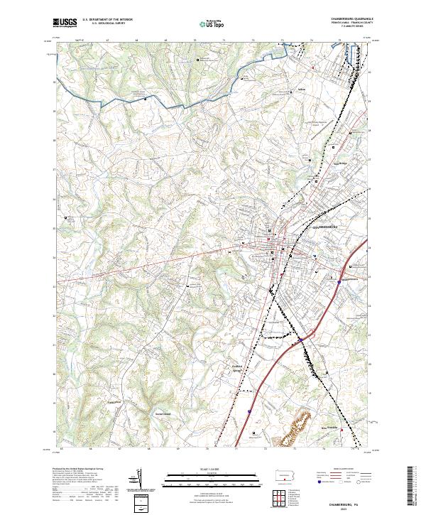
2023 Map of Chambersburg
USGS Topo · Published 2023About this map
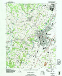
The Franklin County Courthouse serves as the focal point for this detailed modern survey of Chambersburg, where the urban grid intersects with the winding Conococheague Creek. The map documents a landscape deeply etched by generational history, visible through an extensive network of burial grounds like the Rocky Spring Churchyard Cem and family-named sites such as the Samuel Miller Farm Cem. These locations, alongside institutions like Wilson College, reflect the enduring settlement patterns of the Cumberland Valley.
Find a feature on this map
235 named features on this map. Tap any name to fly to it.
Don’t see what you’re looking for? This feature index may not catch every label — zoom into the map to look around manually.
Map Details
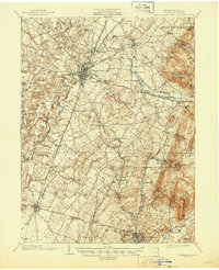
Editions of this 2023 Chambersburg Map
This is the sole edition of this map. No revisions or reprints were ever made.
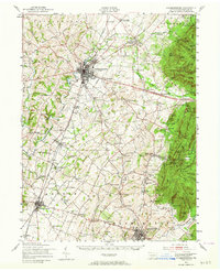
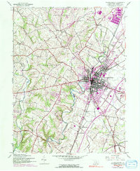
Historical Maps of Kensington Heights Through Time
5 maps found
Featured Locations
- Guilford Township, PA
- Hamilton Township, PA
- Letterkenny Township, PA
- Chambersburg, PA
- St. Thomas Township, PA