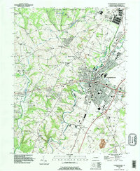
1990 Map of Chambersburg
USGS Topo · Published 1995About this map
Chambersburg serves as the focal point of this 1990 survey, showing the borough's growth alongside established institutions like Wilson College and the Franklin County Prison. The landscape is a mix of dense residential grids and institutional land use, including the sprawling Letterkenny Army Depot to the north and the Chambersburg Municipal Airport. Waterways such as Conococheague Creek and Falling Spring Branch cut through the terrain, historically influencing the placement of landmarks like the Siloam Dam and Red Bridge.
Find a feature on this map
77 named features on this map. Tap any name to fly to it.
Don’t see what you’re looking for? This feature index may not catch every label — zoom into the map to look around manually.
Map Details
Editions of this 1990 Chambersburg Map
This is the sole edition of this map. No revisions or reprints were ever made.
Other maps of this area

1900 · Mercersburg
USGS Topo · 1:62,500

1902 · Chambersburg
USGS Topo · 1:62,500

1902 · Mercersburg
USGS Topo · 1:62,500

1923 · Shippensburg
USGS Topo · 1:62,500

1939 · Orbisonia
USGS Topo · 1:62,500

1940 · Orbisonia
USGS Topo · 1:62,500

1942 · Hagerstown
USGS Topo · 1:125,000

1943 · Hagerstown
USGS Topo · 1:125,000

1943 · Chambersburg
USGS Topo · 1:62,500

1943 · Mercersburg
USGS Topo · 1:62,500
Featured Places
- Chambersburg, PA
- Guilford Township, PA
- Hamilton Township, PA
- Cheesetown, Hamilton Township
- Letterkenny Township, PA