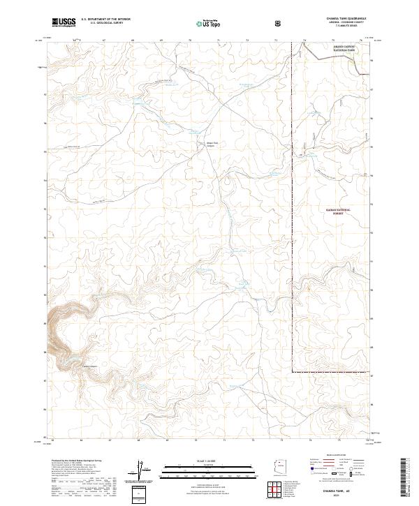
2021 Map of Chamisa Tank
USGS Topo · Published 2021About this map
Grand Canyon National Park and the Kaibab National Forest dominate this high-plateau landscape, where water management is the primary marker of human presence. The map reveals an intricate network of livestock water sources, including named catchments such as Akaba Tank, Cecil Dodd Tank, and the eponymous Chamisa Tank. These features are connected by a sparse network of historical routes, most notably the Supai Village Old 328 Rd. and Topocoba Hilltop Rd, which hint at the region's long-standing connection to nearby indigenous settlements and remote ranching outposts.
Find a feature on this map
31 named features on this map. Tap any name to fly to it.
Don’t see what you’re looking for? This feature index may not catch every label — zoom into the map to look around manually.
Map Details
Editions of this 2021 Chamisa Tank Map
This is the sole edition of this map. No revisions or reprints were ever made.
Other maps of this area

1886 · Chino
USGS Topo · 1:250,000

1886 · Kaibab
USGS Topo · 1:250,000

1891 · Chino
USGS Topo · 1:250,000

1948 · Williams
USGS Topo · 1:250,000

1953 · Grand Canyon
USGS Topo · 1:250,000

1954 · Williams
USGS Topo · 1:250,000

1956 · Williams
USGS Topo · 1:250,000

1957 · Grand Canyon
USGS Topo · 1:250,000

1958 · Grand Canyon
USGS Topo · 1:250,000

1960 · Williams
USGS Topo · 1:250,000