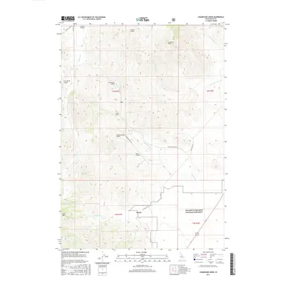
2017 Map of Champagne Creek
USGS Topo · Published 2017About this map
Era and Martin serve as the primary human touchpoints in this high-altitude landscape of Butte County, where water management and conservation dominate the geography. In the southern portion of the quadrangle, the boundary of Craters of the Moon National Monument marks a transition into the stark volcanic terrain near Black Cap. The presence of Martins Ditch near Lava Cr reflects historical efforts to divert water through this arid environment, likely supporting the small settlements and ranching interests found along Champagne Creek Rd. Deep canyons such as Slaughterhouse Canyon and Saint Louis Canyon carve through the high ground, while prominent peaks like Timbered Dome overlook the winding course of Champagne Cr. The map captures a landscape defined by its rugged drainages and the legacy of early high-desert homesteading.
Find a feature on this map
28 named features on this map. Tap any name to fly to it.
Don’t see what you’re looking for? This feature index may not catch every label — zoom into the map to look around manually.
Map Details
Editions of this 2017 Champagne Creek Map
This is the sole edition of this map. No revisions or reprints were ever made.
Other maps of this area

1935 · MacKay
USGS Topo · 1:96,000

1955 · Idaho Falls
USGS Topo · 1:250,000

1958 · Idaho Falls
USGS Topo · 1:250,000

1960 · Grouse
USGS Topo · 1:62,500

1972 · Nichols Reservoir
USGS Topo · 1:24,000

1972 · Inferno Cone
USGS Topo · 1:24,000

1972 · Blizzard Mtn South
USGS Topo · 1:24,000

1972 · Appendicitis Hill
USGS Topo · 1:24,000
1973 · The Watchman
USGS Topo · 1:24,000

1978 · Craters Of The Moon
USGS Topo · 1:100,000