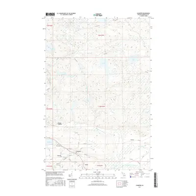
2017 Map of Champion
USGS Topo · Published 2017About this map
The settlement of Champion serves as a central hub in this Marquette County landscape, where the local road network—including Dalliba St, Swedetown St, and Graphite St—reflects the community's residential and industrial foundations. To the west, the village of Beacon sits near the shores of Lake Michigamme, while smaller named points like Wobic, Martins Landing, and Clowry suggest the historical distribution of activity across the township. The Middle Br Escanaba River and its tributaries, including Kipple Cr and Halfway Cr, weave through a terrain defined by numerous bodies of water such as Log Lake, Round Lake, and Dishno Lake. For genealogists, the location of the Sacred Heart Cem provides a specific point of reference for early residents of this northern Michigan mining and timber region.
Find a feature on this map
57 named features on this map. Tap any name to fly to it.
Don’t see what you’re looking for? This feature index may not catch every label — zoom into the map to look around manually.
Map Details
Editions of this 2017 Champion Map
This is the sole edition of this map. No revisions or reprints were ever made.
Other maps of this area

1899 · Witbeck
USGS Topo · 1:62,500

1955 · Champion
USGS Topo · 1:24,000

1955 · Diorite
USGS Topo · 1:24,000

1955 · Witch Lake NE
USGS Topo · 1:24,000

1955 · Greenwood
USGS Topo · 1:24,000

1955 · Republic
USGS Topo · 1:62,500

1955 · Republic
USGS Topo · 1:24,000

1955 · Witch Lake
USGS Topo · 1:62,500

1955 · Champion
USGS Topo · 1:62,500

1956 · Michigamme
USGS Topo · 1:62,500