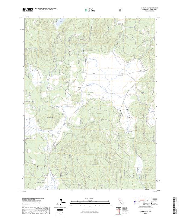
2023 Map of Champs Flat
USGS Topo · Published 2023About this map
Lassen National Forest terrain dominates this 2023 survey of northeastern California, defined by a series of high mountain peaks and secluded mountain valleys. The landscape is punctuated by significant volcanic and geological features like Ashurst Mtn and Logan Mtn, which overlook broad flats and meadows. In the northern reaches, Ashurst Lake and Shays Hole Reservoir provide essential water sources in an otherwise dry high-country environment. The road network is sparse, centered on the historic Champs Flat Road and the curious track of Shoestring Harvey. Named flats like Burgess Flat and Champs Flat suggest the area's long-standing use for seasonal grazing or timber camps. To the south, Pine Creek Valley and Little Antelope Valley indicate the drainage patterns that have shaped this portion of the Sierra-Cascade transition zone.
Find a feature on this map
24 named features on this map. Tap any name to fly to it.
Don’t see what you’re looking for? This feature index may not catch every label — zoom into the map to look around manually.
Map Details
Editions of this 2023 Champs Flat Map
This is the sole edition of this map. No revisions or reprints were ever made.
Other maps of this area

1886 · Honey Lake
USGS Topo · 1:250,000

1886 · Lassen Peak
USGS Topo · 1:250,000

1891 · Honey Lake
USGS Topo · 1:250,000

1892 · Lassen Peak
USGS Topo · 1:250,000

1893 · Honey Lake
USGS Topo · 1:250,000

1894 · Lassen Peak
USGS Topo · 1:250,000

1939 · Halls Flat
USGS Topo · 1:125,000

1955 · Westwood
USGS Topo · 1:250,000

1956 · Hayden Hill
USGS Topo · 1:62,500

1956 · Harvey Mtn
USGS Topo · 1:62,500