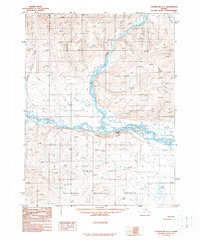
1990 Map of Chandalar A-1
USGS Topo · Published 1990About this map
The East Fork Chandalar River dominates this northern landscape, winding through a complex system of braided channels and sandbars as it flows toward the south. The river valley is flanked by the Chuttoh Bluffs, providing a transition from the elevated stream-cut terrain to the lower-lying Yukon Flats. This region, mapped in the late twentieth century, includes a portion of the Yukon Flats National Wildlife Refuge, where the terrain flattens into a wetland environment characterized by Numerous small lakes and ponds. Human presence is minimal and concentrated, indicated only by a few Cabins positioned near the water's edge. Tributaries like Mountain Creek, Zimmerman Creek, and Crater Creek cut through the surrounding hills, illustrating the drainage patterns that feed into the main river system before it enters the flats.
Find a feature on this map
13 named features on this map. Tap any name to fly to it.
Don’t see what you’re looking for? This feature index may not catch every label — zoom into the map to look around manually.
Map Details
Editions of this 1990 Chandalar A-1 Map
This is the sole edition of this map. No revisions or reprints were ever made.
Other maps of this area

1951 · Fort Yukon
USGS Topo · 1:250,000

1951 · Chandalar
USGS Topo · 1:250,000

1951 · Christian
USGS Topo · 1:250,000

1951 · Beaver
USGS Topo · 1:250,000

1956 · Chandalar
USGS Topo · 1:250,000

1956 · Beaver
USGS Topo · 1:250,000

1956 · Christian
USGS Topo · 1:250,000

1956 · Fort Yukon
USGS Topo · 1:250,000
1956 · Fort Yukon D-6
USGS Topo · 1:63,360

1964 · Chandalar
USGS Topo · 1:250,000