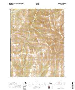
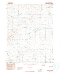
2017 Map of Chandalar A-3 SW
USGS Topo · Published 2017About this map
Monarch Creek and Candle Creek define the drainage of this interior Alaskan wilderness within the Yukon-Koyukuk region. This topographic study emphasizes the steep, complex terrain of the northern Brooks Range foothills, where elevations rise sharply from the creek beds to over 4,000 feet. The landscape is primarily defined by high-altitude ridgelines and narrow valleys, mapped with 40-foot contour intervals to show the intricate branching of alpine stream systems. There are no marked roads, settlements, or structures, leaving the geography entirely to the natural watercourses and the established Public Land Survey System boundaries, which divide the area into Townships 25, 26, and 27 North across Ranges 3 and 4 West. The map provides a precise look at the raw physical geography of this subarctic environment prior to any modern development or infrastructure.
Find a feature on this map
8 named features on this map. Tap any name to fly to it.
Don’t see what you’re looking for? This feature index may not catch every label — zoom into the map to look around manually.
Map Details
Editions of this 2017 Chandalar A-3 SW Map
This is the sole edition of this map. No revisions or reprints were ever made.
Other maps of this area

1951 · Chandalar
USGS Topo · 1:250,000

1951 · Beaver
USGS Topo · 1:250,000

1956 · Chandalar
USGS Topo · 1:250,000

1956 · Beaver
USGS Topo · 1:250,000

1964 · Chandalar
USGS Topo · 1:250,000

1964 · Beaver
USGS Topo · 1:250,000
1970 · Beaver D-4
USGS Topo · 1:63,360
1970 · Chandalar A-4
USGS Topo · 1:63,360
1990 · Chandalar A-3
USGS Topo · 1:63,360
1990 · Beaver D-3
USGS Topo · 1:63,360