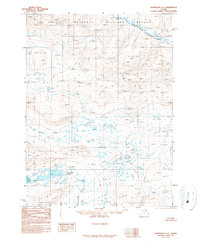
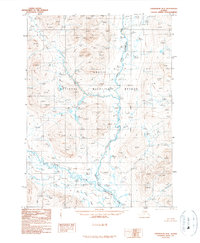
1990 Map of Chandalar C-1
USGS Topo · Published 1990About this map
The Arctic National Wildlife Refuge dominates this northern Alaskan interior, where the confluence of the North Fork Chandalar River and the East Fork Chandalar River shapes the local drainage. This provisional survey captures the Brooks Range landscape as it appeared in the early 1990s, characterized by expansive watersheds and a total absence of road infrastructure. The map reveals a high-latitude wilderness punctuated by water features like the Vunittsieh Lakes and Ackerman Lake. Human presence is minimal and strictly utilitarian, represented only by the small clusters of Cabins located near the shore of Ackerman Lake in the southwest corner. The presence of Glacier Creek and Chekhechunnjik Creek highlights the intricate stream network that feeds the major river forks, providing a detailed record of the hydrological pattern before the impact of more modern environmental shifts.
Find a feature on this map
8 named features on this map. Tap any name to fly to it.
Don’t see what you’re looking for? This feature index may not catch every label — zoom into the map to look around manually.
Map Details
Editions of this 1990 Chandalar C-1 Map
This is the sole edition of this map. No revisions or reprints were ever made.
Other maps of this area

1951 · Chandalar
USGS Topo · 1:250,000

1951 · Christian
USGS Topo · 1:250,000

1956 · Chandalar
USGS Topo · 1:250,000

1956 · Christian
USGS Topo · 1:250,000

1964 · Chandalar
USGS Topo · 1:250,000
1990 · Christian C-6
USGS Topo · 1:63,360

1990 · Chandalar C-2
USGS Topo · 1:63,360
1990 · Christian B-6
USGS Topo · 1:63,360
1990 · Chandalar B-1
USGS Topo · 1:63,360
1990 · Chandalar D-2
USGS Topo · 1:63,360