1967 Map of Chaos Creek
USGS Topo · Published 1973About this map
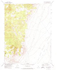
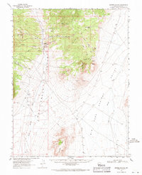
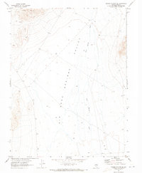
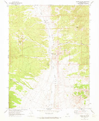
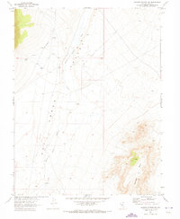
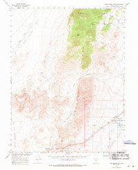
Squaw Hills and the jagged formations of The Needles define this desert landscape in Nye County, Nevada. Mapped in part by the Atomic Energy Commission during the late 1960s, the terrain is marked by essential water sources like Square Wells Spring and Needles Spring, which have long served as vital landmarks in the arid Big Sand Springs Valley. A solitary Jeep Trail provides the primary passage through the hills, connecting the northern reach of Red Ring Mtn to the southern elevations of the Heart Hills. The drainage of Chaos Creek, fed by the North Fork, Middle Fork, and South Fork, flows eastward toward the Sand Springs Wash. Geologic features such as Chaos Knob and Basalt Butte punctuate the landscape, reflecting the area's volcanic and erosional history.
Find a feature on this map
21 named features on this map. Tap any name to fly to it.
Don’t see what you’re looking for? This feature index may not catch every label — zoom into the map to look around manually.
Map Details
Editions of this 1967 Chaos Creek Map
This is the sole edition of this map. No revisions or reprints were ever made.
Other maps of this area

1956 · Lund
USGS Topo · 1:250,000

1956 · Tonopah
USGS Topo · 1:250,000

1959 · Tonopah
USGS Topo · 1:250,000

1960 · Lund
USGS Topo · 1:250,000

1962 · Tonopah
USGS Topo · 1:250,000
1967 · Moores Station
USGS Topo · 1:62,500
1967 · Moores Station SE
USGS Topo · 1:24,000
1967 · Moores Station
USGS Topo · 1:24,000
1967 · Moores Station SW
USGS Topo · 1:24,000
1968 · Portuguese Mtn
USGS Topo · 1:62,500