
1967 Map of Moores Station
USGS Topo · Published 1973About this map
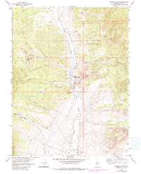
Moores Station serves as the focal point for this 1967 survey of a high-desert landscape in Nye County. The terrain is defined by a series of distinct geological features, most notably the Confusion Hills to the northeast and the Squaw Hills to the southeast. Evidence of ancient human presence is captured at Petrograph Butte, where Petroglyphs are marked along the rugged slopes. The water system is characterized by the wide drainage of Moores Station Wash and the ephemeral Hot Creek. Man-made infrastructure of the mid-century era is visible in the form of a Landing Strip and an Aqueduct that cuts across the southern portion of the map. This study, mapped by the Atomic Energy Commission and the Geological Survey, reveals a landscape utilized for both its natural resources and technical installations, including scattered Drill Holes and a Gravel Pit.
Find a feature on this map
29 named features on this map. Tap any name to fly to it.
Don’t see what you’re looking for? This feature index may not catch every label — zoom into the map to look around manually.
Map Details
Editions of this 1967 Moores Station Map
2 editions found
Other maps of this area

1956 · Tonopah
USGS Topo · 1:250,000

1959 · Tonopah
USGS Topo · 1:250,000

1962 · Tonopah
USGS Topo · 1:250,000

1967 · Moores Station
USGS Topo · 1:62,500

1967 · Moores Station SE
USGS Topo · 1:24,000

1967 · Chaos Creek
USGS Topo · 1:24,000

1967 · Morey Peak
USGS Topo · 1:24,000
1967 · Moores Station SW
USGS Topo · 1:24,000

1968 · Morey Peak
USGS Topo · 1:62,500

1968 · Pritchards Station
USGS Topo · 1:62,500