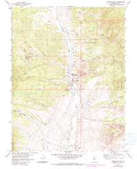
1967 Map of Moores Station
USGS Topo · Published 1982About this map
Moores Station serves as the central landmark for this arid High Desert landscape, mapped in cooperation with the Atomic Energy Commission. The area is defined by its stark geological and cultural features, including ancient Petroglyphs found near Petroglyph Butte at the edge of the Hot Creek drainage. The terrain is notably varied, ranging from the Orange Buttes in the west to the evocative Confusion Hills and Jumbled Rock Buttes in the east.
Find a feature on this map
27 named features on this map. Tap any name to fly to it.
Don’t see what you’re looking for? This feature index may not catch every label — zoom into the map to look around manually.
Map Details
Editions of this 1967 Moores Station Map
2 editions found
Other maps of this area

1956 · Tonopah
USGS Topo · 1:250,000

1959 · Tonopah
USGS Topo · 1:250,000

1962 · Tonopah
USGS Topo · 1:250,000

1967 · Moores Station
USGS Topo · 1:62,500

1967 · Moores Station SE
USGS Topo · 1:24,000

1967 · Moores Station
USGS Topo · 1:24,000

1967 · Chaos Creek
USGS Topo · 1:24,000

1967 · Morey Peak
USGS Topo · 1:24,000
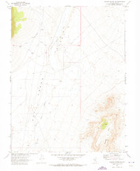
1967 · Moores Station SW
USGS Topo · 1:24,000

1968 · Morey Peak
USGS Topo · 1:62,500