
1967 Map of Morey Peak
USGS Topo · Published 1973About this map
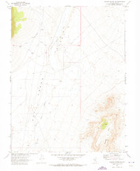
Hot Creek Range dominates this late-1960s survey of Nye County, Nevada, centered on the high elevations of Morey Peak and Mahogany Peak. This high-desert environment is defined by its scarce water sources, as seen in the concentration of named springs such as Lower Fandango Spring, Cold Spring, and Red Spring. The map documents early infrastructure supporting this arid landscape, including a prominent Aqueduct located near Morey, and a network of jeep trails navigating through deep incisions like Sixmile Canyon and Morey Canyon. The presence of Waddles Ridge and Devils Cave Ridge highlights a complex topography of ridges and canyons, including specifically named features like Hacksaw Canyon and Orange Lichen Creek. This survey, produced in cooperation with the Atomic Energy Commission, reflects the remote character of the interior Nevada basin during an era of significant geological and environmental study.
Find a feature on this map
37 named features on this map. Tap any name to fly to it.
Don’t see what you’re looking for? This feature index may not catch every label — zoom into the map to look around manually.
Map Details
Editions of this 1967 Morey Peak Map
This is the sole edition of this map. No revisions or reprints were ever made.
Other maps of this area

1956 · Tonopah
USGS Topo · 1:250,000

1959 · Tonopah
USGS Topo · 1:250,000

1962 · Tonopah
USGS Topo · 1:250,000

1967 · Moores Station
USGS Topo · 1:62,500

1967 · Upper Fish Lake
USGS Topo · 1:24,000

1967 · Moores Station
USGS Topo · 1:24,000
1967 · Moores Station SW
USGS Topo · 1:24,000

1968 · Morey Peak
USGS Topo · 1:62,500

1968 · Pritchards Station
USGS Topo · 1:62,500

1968 · Fish Springs
USGS Topo · 1:62,500