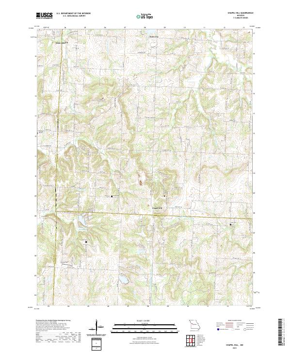
2021 Map of Chapel Hill
USGS Topo · Published 2021About this map
The tri-county junction of Lafayette, Jackson, and Johnson counties anchors this landscape of rolling ridges and headwater streams. The settlement of Chapel Hill sits atop a high divide, historically significant as a waypoint near the source of the N Fork Blackwater River and the Sni-A-Bar Cr drainage. This drainage divide creates a distinct pattern of winding country roads like Colbern Rd and State Hwy TT that follow the topography to avoid the many branching tributaries.
Find a feature on this map
111 named features on this map. Tap any name to fly to it.
Don’t see what you’re looking for? This feature index may not catch every label — zoom into the map to look around manually.
Map Details
Editions of this 2021 Chapel Hill Map
This is the sole edition of this map. No revisions or reprints were ever made.
Other maps of this area

1885 · Warrensburg
USGS Topo · 1:125,000

1887 · Harrisonville
USGS Topo · 1:125,000

1887 · Warrensburg
USGS Topo · 1:125,000

1889 · Lexington
USGS Topo · 1:125,000

1892 · Harrisonville
USGS Topo · 1:125,000

1894 · Harrisonville
USGS Topo · 1:125,000

1894 · Independence
USGS Topo · 1:125,000

1894 · Warrensburg
USGS Topo · 1:125,000

1934 · Oak Grove
USGS Topo · 1:24,000

1935 · Tarsney
USGS Topo · 1:24,000