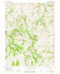
1963 Map of Chapel Hill
USGS Topo · Published 1964About this map
Chapel Hill sits at the nexus of several rural townships where the headwaters of the South Fork Blackwater River and Sni-A-Bar Creek meet. This early 1960s survey documents a landscape defined by its stream network and the dividing lines of Jackson, Lafayette, and Johnson counties. The drainage patterns are intricate, with Horseshoe Creek and Little Horseshoe Creek carving through the northwest, while the East Fork Sni-A-Bar Creek moves through the central sections. For local historians, the map preserves the exact locations of several smaller community landmarks, including Concord Ch and numerous family or church burial grounds such as Hill Cem, Cobb Cem, and Shore Cem. A solitary Radio Tower and scattered Gravel Pit workings represent the modest industrial and infrastructure footprint in this predominantly agricultural region during the mid-century period.
Find a feature on this map
18 named features on this map. Tap any name to fly to it.
Don’t see what you’re looking for? This feature index may not catch every label — zoom into the map to look around manually.
Map Details
Editions of this 1963 Chapel Hill Map
This is the sole edition of this map. No revisions or reprints were ever made.
Other maps of this area

1885 · Warrensburg
USGS Topo · 1:125,000

1887 · Harrisonville
USGS Topo · 1:125,000

1887 · Warrensburg
USGS Topo · 1:125,000

1889 · Lexington
USGS Topo · 1:125,000

1892 · Harrisonville
USGS Topo · 1:125,000

1894 · Harrisonville
USGS Topo · 1:125,000

1894 · Independence
USGS Topo · 1:125,000

1894 · Warrensburg
USGS Topo · 1:125,000

1934 · Oak Grove
USGS Topo · 1:24,000

1935 · Tarsney
USGS Topo · 1:24,000